Breaking News
Showing posts with label CO. Show all posts

Monday, 15 August 2016

Wildfires in Russia's Far East

Wildfires can add huge amounts of carbon dioxide (CO2), carbon monoxide (CO), methane (CH4), nitrous oxide (N2O) and black carbon (BC or soot) into the atmosphere.

While CO and soot are not included as greenhouse gases by the IPCC, they can have strong warming impact. CO acts as a scavanger of hydroxyl, thus extending the lifetime of methane. BC results from biomass burning, which a study by Mark Jacobson found to cause 20 year global warming of ~0.4 K. Moreover, BC has a darkening effect when settling on snow and ice, making that less sunlight gets reflected back into space, which accelerates warming. This hits the Arctic particularly hard during the Northern Summer, given the high insolation at high latitudes at that time of year.

The image below shows fires around the globe on August 12, 2016.


Visible in the top right corner of above image are wildfires in Russia’s Far East. The image below zooms in on these wildfires.


The image below shows carbon dioxide levels as high as 713 ppm and carbon monoxide levels as high as 32,757 ppb on August 12, 2016, at the location marked by the green circle, i.e. the location of the wildfires in Russia’s Far East.


As said, wildfires can also emit huge amounts of methane. The image below shows methane levels as high as 2230 ppb at 766 mb.


The magenta-colored areas on above image and the image below indicate that these high methane levels are caused by these wildfires in Russia’s Far East. The image below shows methane levels as high as 2517 ppb at 586 mb.


Methane levels as high as 2533 ppb were recorded that day (at 469 mb), compared to a mean global peak of 1857 ppb that day.

Analysis by Global Fire Data found that the 2015 Indonesian fires produced more CO2e (i.e. CO2 equivalent of, in this case, CO2, CH4 and N2O) than the 2013 CO2 emissions from fossil fuel by nations such as Japan and Germany. On 26 days in August and September 2015, emissions from Indonesian fires exceeded the average daily emissions from all U.S. economic activity, as shown by the WRI image below.

A recent study calculated that Indonesia’s 2015 fires killed 100,000 people.

Methane emissions from wildfires can sometimes be broken down relatively quickly, especially in the tropics, due to the high levels of hydroxyl in the atmosphere there. Conversily, methane from wildfires at higher latitudes can persist much longer and will have strong warming impact, especially at higher latitudes.

Similarly, CO2 emissions from wildfires in the tropics can sometimes be partly compensated for by regrowth of vegetation after the fires. However, regrowth can be minimal in times of drought, when forests are burned to make way for other land uses or when peat is burned, and especially at higher latitudes where the growth season is short and weather conditions can be harsh. Carbon in peat lands was built up over thousands of years and even years of regrowth cannot compensate for this loss.

A recent study concludes that there is strong correlation between fire risk for South America and high sea surface temperatures in the Pacific Ocean and the Atlantic Ocean. This makes the current situation very threatening. As the image below shows, sea surface temperature anomalies were very high on August 12, 2016.

Sea surface temperature and anomaly. Anomalies from +1 to +2 degrees C are red, above that they turn yellow and white
Above image also shows that on August 12, 2016, sea surface temperatures near Svalbard (at the location marked by the green circle) were as high as 18.9°C or 65.9°F, an anomaly of 13.6°C or 24.4°F. These high temperatures threaten to melt away the Arctic’s snow and ice cover, resulting in albedo changes that accelerate warming, particularly in the Arctic. Warming of the Arctic Ocean further comes with the danger that methane hydrates at its seafloor will destabilize and make that huge amounts of methane will enter the atmosphere.

The situation is dire and calls for comprehensive and effective action, as described in the Climate Plan.


Links

• Effects of biomass burning on climate, accounting for heat and moisture fluxes, black and brown carbon, and cloud absorption effects, by Mark Z. Jacobson (2014)
http://onlinelibrary.wiley.com/doi/10.1002/2014JD021861/abstract

• 2016 fire risk for South America
http://www.ess.uci.edu/~amazonfirerisk/ForecastWeb/SAMFSS2016.html

• Global Fire Data - 2015 Indonesian fires
http://www.globalfiredata.org/updates.html#2015_indonesia

• Indonesia’s Fire Outbreaks Producing More Daily Emissions than Entire US Economy (2015)
http://www.wri.org/blog/2015/10/indonesia%E2%80%99s-fire-outbreaks-producing-more-daily-emissions-entire-us-economy

• Indonesia’s 2015 fires killed 100,000 people, study finds
http://www.climatechangenews.com/2016/09/19/indonesias-2015-fires-killed-100000-people-study-finds

• Smoke from 2015 Indonesian fires may have caused 100,000 premature deaths
https://www.seas.harvard.edu/news/2016/09/smoke-from-2015-indonesian-fires-may-have-caused-100000-premature-deaths

• High Temperatures in the Arctic
http://arctic-news.blogspot.com/2015/06/high-temperatures-in-the-arctic.html


Read more ...

Tuesday, 3 May 2016

Wildfire Danger Increasing

Wildfires are starting to break out in British Columbia, Canada. The wildfire on the image below started on May 1, 2016 (hat tip to Hubert Bułgajewski‎).


The coordinates of the wildfire are in the bottom left corner of above map. They show a location where, on May 3, 2016, it was 26.0°C (or 78.8°F). At a nearby location, it was 27.6°C (or 81.8°F) on May 3, 2016. Both locations are indicated on the map on the right.

These locations are on the path followed by the Mackenzie River, which ends up in the Arctic Ocean. Wildfires aggravate heat waves as they blacken the soil with soot. As the Mackenzie River heats up, it will bring warmer water into the Arctic Ocean where this will speed up melting of the sea ice.

Moreover, winds can carry soot high up into the Arctic, where it can settle on the sea ice and darken the surface, which will make that more sunlight gets absorbed, rather than reflected back into space as before.

The danger of wildfires increases as temperatures rise. The image on the right show that temperatures in this area on May 3, 2016 (00:00 UTC) were at the top end of the scale, i.e. 20°C or 36°F warmer than 1979-2000 temperatures.

Extreme weather is becoming increasingly common, as changes are taking place to the jet stream. As the Arctic warms up more rapidly than the rest of the world, the temperature difference between the Equator and the North Pole decreases, which in turn weakens the speed at which the north polar jet stream circumnavigates the globe.

This is illustrated by the wavy patterns of the jet stream in the image on the right, showing the situation on May 3, 2016 (00:00 UTC), with a loop bringing warm air high up into North America and into the Arctic.

In conclusion, warm air reaching high latitudes is causing the sea ice to melt in a number of ways:
  • Warm air makes the ice melt directly. 
  • Warmer water in rivers warms up the Arctic Ocean. 
  • Wildfires blacken land and sea ice, causing more sunlight to be absorbed, rather than reflected back into space as before.  
[ click on images to enlarge ]
The situation doesn’t appear to be improving soon, as illustrated by the image on the right. Following the record high temperatures that hit the world earlier this year, the outlook for the sea ice looks bleak.

Further decline of the snow and ice cover in the Arctic looks set to make a number of feedbacks kick in stronger, with methane releases from the seafloor of the Arctic Ocean looming as a huge danger.

NSIDC scientist Andrew Slater has created the chart below of freezing degree days in 2016 compared to other years at Latitude 80°N. See Andrew’s website and this page for more on this.
Below is a comparison of temperatures and emissions for the two locations discussed above. Such fires are becoming increasingly common as temperatures rise, and they can cause release of huge amounts of carbon dioxide, carbon monoxide, methane, sulfur dioxide, soot, etc.

May 3, 2016, at a location north of Fort St John, British Columbia, Canada.
May 4, 2016, near Fort McMurray, Alberta, Canada.
The video below shows methane levels (in parts per billion or ppb) on May 3, 2016, pm, starting at 44,690 ft or 13,621 m and coming down to 5,095 ft or 1,553 m altitude. In magenta-colored areas, methane is above 1950 ppb.


In the video below, Paul Beckwith discusses the situation.


Wildfires are also devastating other parts of the Earth. Below is an image showing wildfires over the Amur River on May 7, 2016.


The image below shows carbon monoxide levels over the Amur River as high as 22,480 ppb on May 9, 2016. Hat tip to Grofu Antoniu for pointing at the CO levels. According to this Sputniknews report, a state of emergency was declared in the Amur Region as fires stretched across 12,200 acres.


The video below shows carbon monoxide emissions in eastern Asia from May 1 to May 26, 2016.

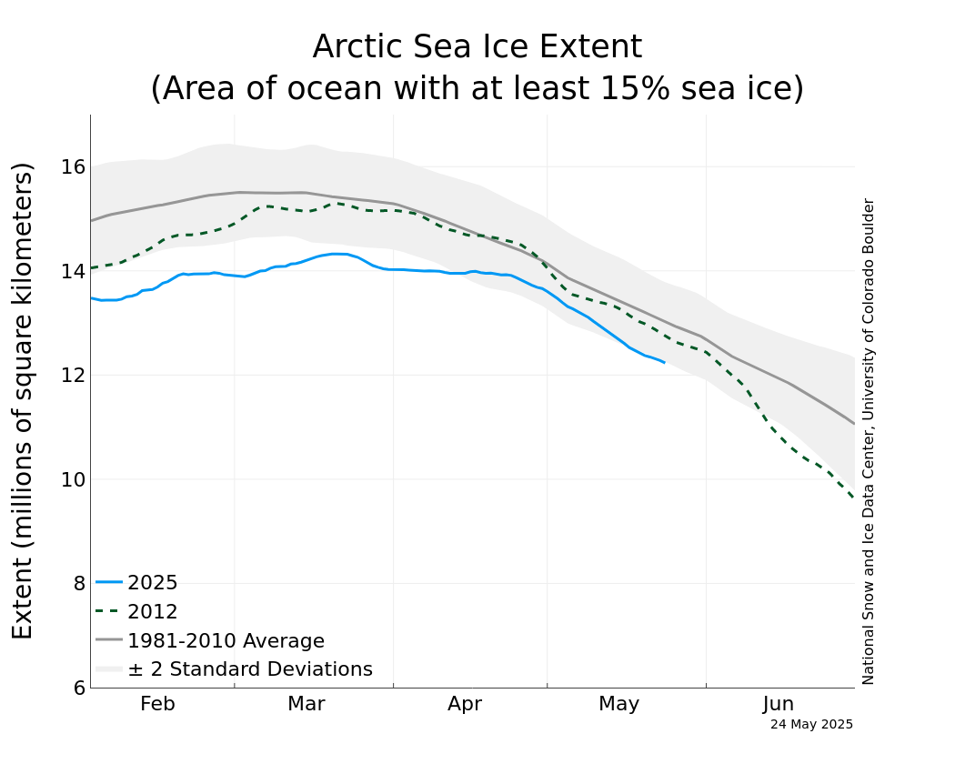
Meanwhile, the National Snow and Ice Data Center (NSIDC) has resumed daily sea ice extent updates with provisional data. The image below is dated May 5, 2016, check here for updates.

As illustrated by the image below, from JAXA, sea ice extent on May 6, 2016, was under 12 million square km, more than 15 days ahead on extent in the year 2012, which was 12 million square km on May 21, 2012.


The situation is dire and calls for comprehensive and effective action as described in the Climate Plan.

Malcolm Light comments:

Most natural processes on the Earth are run by convection including plate tectonics that moves the continental and oceanic plates across the surface of the planet. Mother Earth has been able to hold its atmospheric temperature within certain limits and maintain an ocean for more than 3 billion years because each time there was a build up of carbon dioxide in the atmosphere which produced a global fever, Mother Earth it eliminated the living creatures with a massive Arctic methane firestorm that fried them alive. This giant Arctic methane firestorm is a natural antibiotic the Earth uses to rid itself of those creatures that have overproduced carbon dioxide and caused a global fever.

Essentially mankind has again caused a massive build up of fossil fuel carbon dioxide in the atmosphere and Mother Earth has already started to respond with the predicted massive Arctic methane blow out (since 2010) which will lead to an Earth engulfing firestorm in 5 to 8 years.

The giant fires in the Fort McMurray region are a result of atmospheric methane induced heating of the Arctic and 93.5% global warming of the oceans that has generated a massive El Nino event this year. Hot winds moving away from these high pressure areas have generated high temperatures and massive fires in Alberta which is a giant fever spot on Earth where mankind has produced the maximum amount of dirty fossil fuel extraction and pollution in Canada.

Mother Earth will continue to respond more vigorously with her Arctic methane antibiotic to eliminate the humans from her system as we represent nothing more to her than a larger version of an influenza virus which has seriously retarded her oceanic and atmospheric temperature range functioning systems.

If we do not immediately stop fossil fuel extraction worldwide and control the Arctic methane emission sites we will all be stardust before a decade is past.

Links

• The Threat of Wildfires in the North
http://arctic-news.blogspot.com/2013/06/the-threat-of-wildfires-in-the-north.html

• Smoke Blankets North America
Read more ...

Tuesday, 13 August 2013

More on Wildfires


Previous posts have highlighted the huge amounts of carbon dioxide, methane and soot being emitted as a result of wildfires. Apart from this, there are further important pollutants to consider in regard to their potential to contribute to warming, especially at high latitudes.

The image below, dated August 7, 2013, and kindly supplied by Leonid Yurganov, shows high levels of carbon monoxide as a result of wildfires in Siberia, reaching high up into the Arctic all the way to Greenland. 

[ click on image to enlarge ]
Formation of tropospheric ozone mostly occurs when nitrogen oxides (NOx), carbon monoxide (CO) and volatile organic compounds (VOCs) react in the atmosphere in the presence of sunlight. NOx, CO, and VOCs are therefore called ozone precursors. Apart from a health hazard, tropospheric ozone is an important greenhouse gas. Furthermore, carbon monoxide emissions contribute to hydroxyl depletion, thus extending the lifetime of methane.

While there appears to be little or no carbon dioxide from wildfires over North America on the above August 7 image, there are many recent wildfires raging over the North American continent, as illustrated by the August 12 map below, from Wunderground. 

[ click on image to enlarge ]
This point is illustrated even better on the image below [added later, ed.] showing a composite image with carbon monoxide over July 3-13, 2013. Carbon monoxide resulting from wildfires in Canada is seen crossing the Atlantic Ocean, due to the Coriolis effect, as well as reaching Greenland in large amounts.

[ click on image to enlarge ]


Related

- Wildfires even more damaging
http://arctic-news.blogspot.com/2013/07/wildfires-even-more-damaging.html

- The Threat of Wildfires in the North
http://arctic-news.blogspot.com/2013/06/the-threat-of-wildfires-in-the-north.html

- Wildfires in Canada affect the Arctic
http://arctic-news.blogspot.com/2013/07/wildfires-in-canada-affect-the-arctic.html

Read more ...
Designed By Published.. Blogger Templates